Hurricanes

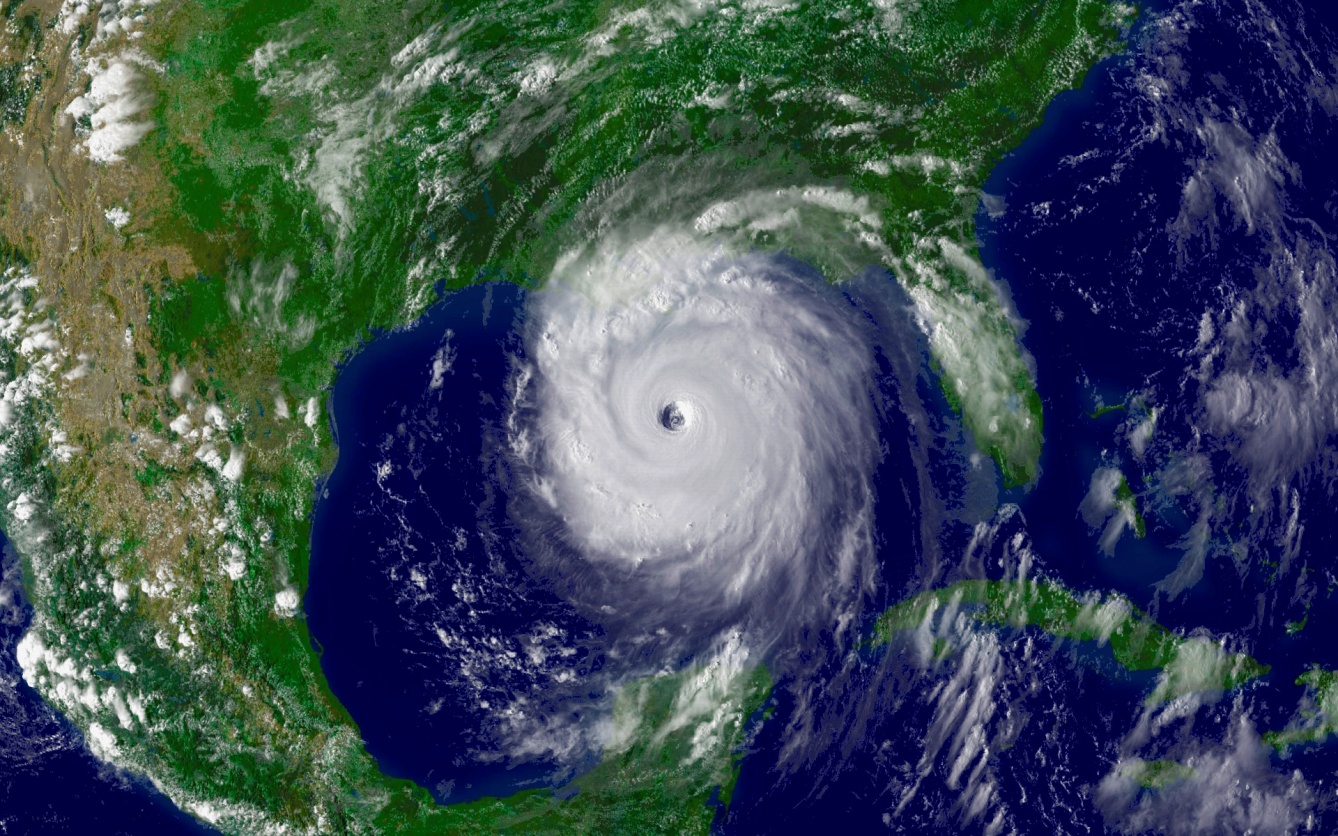
A tropical cyclone is a rotating, organized system of clouds and thunderstorms that originates over tropical or subtropical waters and has a closed low-level circulation. Tropical cyclones rotate counterclockwise in the Northern Hemisphere. The Atlantic hurricane season runs from June 1st to November 30th, however, these storms can develop before or after the season.

Conditions Which Must Be Present in the Development of a Tropical Cyclone

  1. Low-pressure system
  2. Warm temperatures over the Ocean
  3. Moist environment (precipitation)
  4. Tropical wind patterns over the equator

STORM SURGE - A hurricane can produce destructive storm surge, which is water that is pushed toward the shore by the force of the winds swirling around the storm. This advancing surge combines with the normal tides to create the hurricane storm tide, which can increase the mean water level 15 feet or more.

INLAND FLOODING - In the last 30 years, inland flooding has been responsible for more than half the deaths associated with tropical cyclones in the United States.

HIGH WINDS - Hurricane-force winds can destroy poorly constructed buildings and mobile homes. Debris such as signs, roofing material, and small items left outside become flying missiles in hurricanes.

TORNADOES - Hurricanes can produce tornadoes that add to the storm's destructive power. Tornadoes are most likely to occur in the right-front quadrant of the hurricane.

Graphical Hurricane Local Statement:

Issued by local National Weather Service offices to provide more specific information about potential impacts of a tropical storm or hurricane on a particular area. View your Hurricane Local Statement from the National Weather Service at http://www.weather.gov/ghls/.

Separate sets of hurricane names are used in the central Pacific, eastern Pacific, and the Atlantic Basin, which includes the Caribbean Sea and the Gulf of Mexico. The World Meteorological Organization's Region 4 Hurricane Committee selects the names for Atlantic Basin storms. The names are English, Spanish and French - the languages spoken in the national Atlantic Basin storms hit. They alternate between male and female names. The group has selected six sets of names, which means each set of names is used again each six years.


For future hurricane season names, click here http://www.nhc.noaa.gov/aboutnames.shtml

Eye:The eye is the "hole" at the center of the storm. Winds are light in this area. Skies are partly cloudy, and sometimes even clear.

Eye Wall: The eye wall is a ring of thunderstorms. These storms swirl around the eye. The wall is where winds are strongest and rain is heaviest.

Rain Bands: Bands of clouds and rain go far out from a hurricane's eye wall. These bands stretch for hundreds of miles. They contain thunderstorms and sometimes tornadoes.

Familiarize yourself with these terms to help identify a hurricane hazard: Tropical Cyclone: A warm-core non-frontal synoptic-scale cyclone, originating over tropical or subtropical waters, with organized deep convection and a closed surface wind circulation about a well-defined center. Once formed, a tropical cyclone is maintained by the extraction of heat energy from the ocean at high temperature and heat export at the low temperatures of the upper troposphere.

Tropical Depression:A tropical cyclone in which the maximum sustained surface wind speed (using the U.S. 1-minute average) is 38 mph (33 knot) or less.

Tropical Storm A tropical cyclone in which the maximum sustained surface wind speed (using the U.S. 1-minute average) ranges from 39 mph (34 knots) to 73 mph (63 knots). Hurricane: A tropical cyclone in which the maximum sustained surface wind (using the U.S. 1-minute average) is 74 mph (64 knots) or more.

Storm Surge: An abnormal rise in sea level accompanying a hurricane or other intense storm, and whose height is the difference between the observed level of the sea surface and the level that would have occurred in the absence of the cyclone. Storm surge is usually estimated by subtracting the normal or astronomic high tide from the observed storm tide. Storm surge can reach heights well over 20 feet and can span hundreds of miles of coastline.

Storm Tide: The actual level of sea water resulting from the astronomic tide combined with the storm surge.

Hurricane Warning: An announcement that hurricane conditions (sustained winds of 74 mph or higher) are expected somewhere within the specified area. Because hurricane preparedness activities become difficult once winds reach tropical storm force, the hurricane warning is issued 36 hours in advance of the anticipated onset of tropical-storm-force winds.

Hurricane Watch: An announcement that hurricane conditions (sustained winds of 74 mph or higher) are possible within the specified area. Because hurricane preparedness activities become difficult once winds reach tropical storm force, the hurricane watch is issued 48 hours in advance of the anticipated onset of tropical-storm-force winds.

Tropical Storm Warning: An announcement that tropical storm conditions (sustained winds of 39 to 73 mph) are expected somewhere within the specified area within 36 hours.

Tropical Storm Watch: An announcement that tropical storm conditions (sustained winds of 39 to 73 mph) are possible within the specified area within 48 hours.

Governor's Office of Homeland Security & Emergency Preparedness
7667 Independence Blvd.
Baton Rouge, LA 70806
(225) 925-7500
______

Terms    |    Privacy    |   Public Information Request    |    Office of the Governor: Jeff Landry   |    Copyright - GOHSEP

Governor's Office of Homeland Security & Emergency Preparedness